
mahendrapur topographic map
Interactive map
Click on the map to display elevation.
About this map
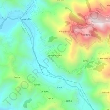
Name: mahendrapur topographic map, elevation, terrain.
Location: mahendrapur, Dhanaulti, Tehri Garhwal, Uttarakhand, India (30.31052 78.12820 30.35052 78.16820)
Average elevation: 1,043 m
Minimum elevation: 699 m
Maximum elevation: 1,731 m