
Jafrabad topographic map
Interactive map
Click on the map to display elevation.
About this map
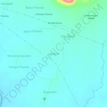
Name: Jafrabad topographic map, elevation, terrain.
Location: Jafrabad, Bayyaram mandal, Mahabubabad, Telangana, India (17.57015 80.08812 17.61015 80.12812)
Average elevation: 182 m
Minimum elevation: 157 m
Maximum elevation: 374 m