
Bhitri topographic map
Interactive map
Click on the map to display elevation.
About this map
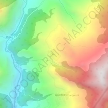
Name: Bhitri topographic map, elevation, terrain.
Location: Bhitri, Mori, Uttarkashi, Uttarakhand, India (31.10512 78.07600 31.14512 78.11600)
Average elevation: 2,179 m
Minimum elevation: 1,474 m
Maximum elevation: 3,086 m