
Kodangal topographic map
Interactive map
Click on the map to display elevation.
About this map
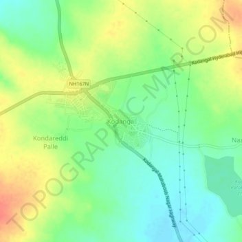
Name: Kodangal topographic map, elevation, terrain.
Location: Kodangal, Kodangal mandal, Vikarabad, Telangana, 509338, India (17.08599 77.60869 17.12599 77.64869)
Average elevation: 553 m
Minimum elevation: 531 m
Maximum elevation: 582 m