
Nilavade topographic map
Interactive map
Click on the map to display elevation.
About this map
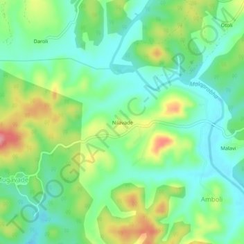
Name: Nilavade topographic map, elevation, terrain.
Location: Nilavade, Khanapura taluku, Belgaum district, Karnataka, India (15.63817 74.39888 15.67817 74.43888)
Average elevation: 695 m
Minimum elevation: 656 m
Maximum elevation: 768 m