
Mulugu topographic map
Interactive map
Click on the map to display elevation.
About this map
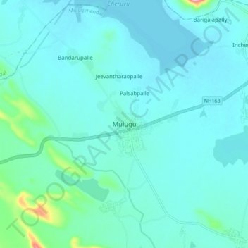
Name: Mulugu topographic map, elevation, terrain.
Average elevation: 225 m
Minimum elevation: 204 m
Maximum elevation: 381 m
Other topographic maps
Click on a map to view its topography, its elevation and its terrain.
Laknavaram Lake
India > Telangana > Mulug mandal > Ankannagudem
Laknavaram Lake, Ankannagudem, Mulug mandal, Mulugu District, Telangana, India
Average elevation: 207 m