
Kunnamangalam topographic map
Interactive map
Click on the map to display elevation.
About this map
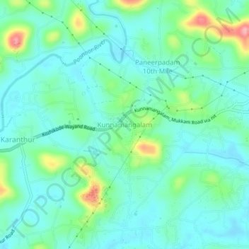
Name: Kunnamangalam topographic map, elevation, terrain.
Location: Kunnamangalam, Kozhikode, Kerala, 673571, India (11.28468 75.85856 11.32468 75.89856)
Average elevation: 35 m
Minimum elevation: 7 m
Maximum elevation: 126 m
Other topographic maps
Click on a map to view its topography, its elevation and its terrain.