
C N Robertson Pond Dam topographic map
Interactive map
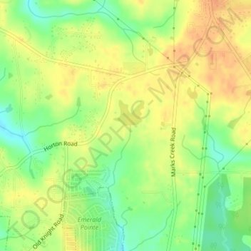
Click on the map to display elevation.
About this map
Name: C N Robertson Pond Dam topographic map, elevation, terrain.
Average elevation: 103 m
Minimum elevation: 81 m
Maximum elevation: 119 m
Other topographic maps
Click on a map to view its topography, its elevation and its terrain.
Graham County
United States of America > North Carolina
According to the U.S. Census Bureau, the county has a total area of 302 square miles (780 km2), of which 292 square miles (760 km2) is land and 9.6 square miles (25 km2) (3.2%) is water. The terrain of the county is mountainous, with elevations ranging from 1,177 feet (359 m) to 5,560 feet (1,690 m).…
Average elevation: 850 m
Davidson County
United States of America > North Carolina
Davidson County is located entirely within the Piedmont region of central North Carolina. The Piedmont consists of gently rolling terrain frequently broken by hills or shallow valleys formed by rivers and streams. An exception to this terrain are the Uwharrie Mountains in the county's western and southwestern…
Average elevation: 222 m
Pamlico County
United States of America > North Carolina
The county was formed in 1872 from parts of Beaufort and Craven counties. It was named for Pamlico Sound, which adjoins it. Vernacular usage in the area, especially in Craven County, refers to Pamlico County as being "down in the county." Prior to 1872, it was a part of Craven County and has a very low…
Average elevation: 5 m