
Volovsky District topographic map
Interactive map
Click on the map to display elevation.
About this map
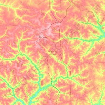
Name: Volovsky District topographic map, elevation, terrain.
Average elevation: 230 m
Minimum elevation: 160 m
Maximum elevation: 280 m
Other topographic maps
Click on a map to view its topography, its elevation and its terrain.
Tula
Russia > Tula Oblast > городской округ Тула > Tula
Tula, городской округ Тула, Tula Oblast, Central Federal District, Russia
Average elevation: 199 m
Tula Oblast
Tula Oblast, Central Federal District, Russia
Average elevation: 207 m