
Murtijapur topographic map
Interactive map
Click on the map to display elevation.
Murtijapur
Murtizapur is located at an average elevation of 308 metres (1210 feet). It is an important railway junction station in Akola district and is under Bhusawal-Badnera Section of Bhusawal Division of Central Railway.
About this map
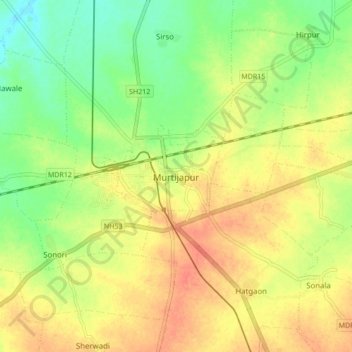
Name: Murtijapur topographic map, elevation, terrain.
Location: Murtijapur, Akola, Maharashtra, 444107, India (20.69465 77.32993 20.77465 77.40993)
Average elevation: 300 m
Minimum elevation: 274 m
Maximum elevation: 323 m
Other topographic maps
Click on a map to view its topography, its elevation and its terrain.
Murtijapur
India > Maharashtra > Murtijapur
Murtizapur is located at an average elevation of 308 metres (1210 feet). It is an important railway junction station in Akola district and is under Bhusawal-Badnera Section of Bhusawal Division of Central Railway.
Average elevation: 308 m