
Piravom topographic map
Interactive map
Click on the map to display elevation.
Piravom
The panchayat had been a municipality for a brief period of about two years before it was reverted to a panchayat in 1992 after skepticism that a municipality would attract higher tax rate and complexities of building rules. However, the municipal councils now have the authority to fix the tax rate while building rule provisions are already applicable to special grade Panchayats. The panchayat had passed a unanimous resolution for the elevation. In 2015, Kerala government elevated Piravom panchayat to a municipality along with several other towns in Kerala.
About this map
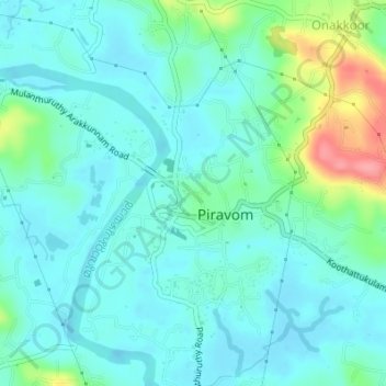
Name: Piravom topographic map, elevation, terrain.
Location: Piravom, Muvattupuzha, Ernakulam district, Kerala, 686664, India (9.86216 76.46936 9.88828 76.50349)
Average elevation: 21 m
Minimum elevation: -3 m
Maximum elevation: 97 m
Other topographic maps
Click on a map to view its topography, its elevation and its terrain.