
Kuliyankal topographic map
Interactive map
Click on the map to display elevation.
About this map
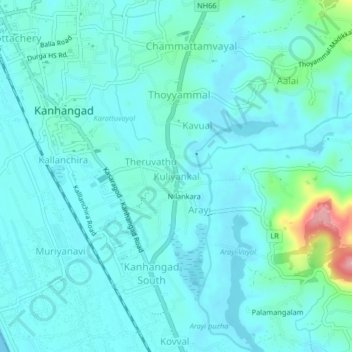
Name: Kuliyankal topographic map, elevation, terrain.
Location: Kuliyankal, Hosdurg, Kasaragod, Kerala, 671314, India (12.28607 75.08556 12.32607 75.12556)
Average elevation: 19 m
Minimum elevation: 0 m
Maximum elevation: 130 m