
Somra topographic map
Interactive map
Click on the map to display elevation.
About this map
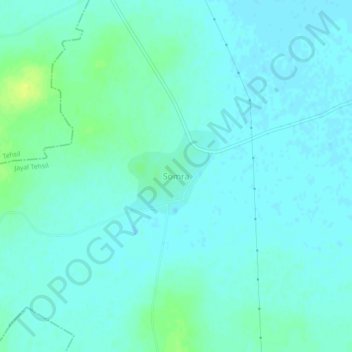
Name: Somra topographic map, elevation, terrain.
Location: Somra, Jayal Tehsil, Nagaur, Rajasthan, India (27.23070 73.92661 27.27070 73.96661)
Average elevation: 297 m
Minimum elevation: 293 m
Maximum elevation: 310 m