
Pathri topographic map
Interactive map
Click on the map to display elevation.
About this map
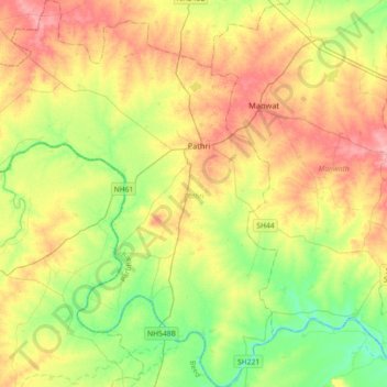
Name: Pathri topographic map, elevation, terrain.
Location: Pathri, Parbhani, Maharashtra, 431506, India (19.05005 76.20776 19.39154 76.50635)
Average elevation: 415 m
Minimum elevation: 373 m
Maximum elevation: 466 m
Other topographic maps
Click on a map to view its topography, its elevation and its terrain.
Mahadev Nagar
India > Maharashtra > Pathri
Mahadev Nagar, Pathri, Parbhani, Maharashtra, 431506, India
Average elevation: 412 m