
Thayyannur topographic map
Interactive map
Click on the map to display elevation.
About this map
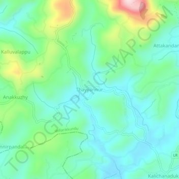
Name: Thayyannur topographic map, elevation, terrain.
Location: Thayyannur, Hosdurg, Kasaragod, Kerala, 671531, India (12.32951 75.17444 12.36951 75.21444)
Average elevation: 127 m
Minimum elevation: 35 m
Maximum elevation: 392 m