
Kolhūpāni topographic map
Interactive map
Click on the map to display elevation.
About this map
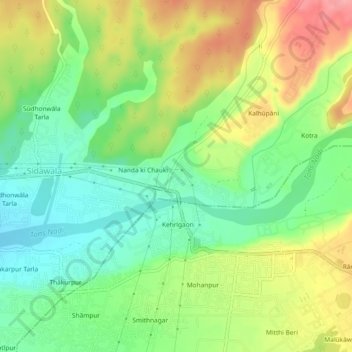
Name: Kolhūpāni topographic map, elevation, terrain.
Location: Kolhūpāni, Vikasnagar, Dehradun, Uttarakhand, 248007, India (30.32501 77.93443 30.36501 77.97443)
Average elevation: 603 m
Minimum elevation: 555 m
Maximum elevation: 670 m