
France topographic map
Interactive map
Click on the map to display elevation.
About this map
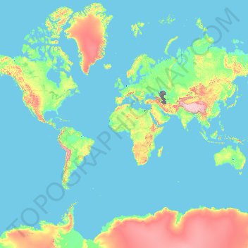
Name: France topographic map, elevation, terrain.
Location: France (-50.21872 -178.38737 51.30557 172.30572)
Average elevation: 430 m
Minimum elevation: -30 m
Maximum elevation: 6,542 m
Metropolitan France has a wide variety of topographical sets and natural landscapes. Large parts of the current territory of France were raised during several tectonic episodes like the Hercynian uplift in the Paleozoic Era, during which the Armorican Massif, the Massif Central, the Morvan, the Vosges and Ardennes ranges and the island of Corsica were formed. These massifs delineate several sedimentary basins such as the Aquitaine basin in the southwest and the Paris basin in the north, the latter including several areas of particularly fertile ground such as the silt beds of Beauce and Brie. Various routes of natural passage, such as the Rhône Valley, allow easy communication. The Alpine, Pyrenean and Jura mountains are much younger and have less eroded forms. At 4,810.45 metres (15,782 ft) above sea level, Mont Blanc, located in the Alps on the French and Italian border, is the highest point in Western Europe. Although 60% of municipalities are classified as having seismic risks, these risks remain moderate.
Other topographic maps
Click on a map to view its topography, its elevation and its terrain.
Hyderabad
India > Telangana > Bahadurpura mandal
Hyderabad, Bahadurpura mandal, Hyderabad District, Telangana, India
Average elevation: 549 m
Sri Lanka
Sri Lanka
Average elevation: 50 m
India
India
Average elevation: 1,017 m
Montreal
Canada > Quebec > Urban agglomeration of Montreal > Montreal
Montreal, Urban agglomeration of Montreal, Montreal (06), Quebec, H3B 1M7, Canada
Average elevation: 30 m
Navi Mumbai
India > Maharashtra > Thane > Navi Mumbai
Navi Mumbai, Mumbai Metropolitan Region, Thane, Maharashtra, 400706, India
Average elevation: 30 m
Pune
India > Maharashtra > Pune City > Pune
Pune, Pune City, Pune District, Maharashtra, 411001, India
Average elevation: 641 m
Tacoma
United States > Washington > Pierce County
Tacoma, Pierce County, Washington, United States
Average elevation: 67 m
Kandy
Kandy, Kandy District, Central Province, 20000, Sri Lanka
Average elevation: 621 m
Bengaluru
India > Karnataka > Bangalore North
Bengaluru, Bangalore North, Bengaluru Urban District, Karnataka, India
Average elevation: 881 m
Mangaluru
India > Karnataka > Mangaluru taluk
Mangaluru, Mangaluru taluk, Dakshina Kannada District, Karnataka, 575001, India
Average elevation: 25 m
Sulusaray Beldesi
Sulusaray Beldesi, Nevşehir Merkez, Nevşehir, Central Anatolia Region, Turkey
Average elevation: 1,008 m
Musi River
Musi River, Hyderabad, Uppal mandal, Medchal–Malkajgiri, Telangana, 5000036, India
Average elevation: 490 m
Colombo
Colombo, Colombo District, Western Province, Sri Lanka
Average elevation: 5 m
Vadodara
India > Gujarat > Vadodara Taluka
Vadodara, Vadodara Taluka, Vadodara District, Gujarat, 390001, India
Average elevation: 36 m
Chennai
India > Tamil Nadu > Chennai
Chennai, Chennai District, Tamil Nadu, India
Average elevation: 8 m
Anaikatti
India > Tamil Nadu > Coimbatore North
Anaikatti, Mannarkad, Palakkad District, Kerala, 678741, India
Average elevation: 623 m
Kurunegala
Sri Lanka > North Western Province
Kurunegala, Kurunegala District, North Western Province, 60000, Sri Lanka
Average elevation: 146 m
Snohomish County
Snohomish County, Washington, United States
Average elevation: 649 m
Gopasandra
India > Karnataka > Mulubagilu taluk
Gopasandra, Mulubagilu taluk, Kolar District, Karnataka, India
Average elevation: 804 m
Dehradun
India > Uttarakhand > Dehradun
Dehradun, Dehradun District, Uttarakhand, 248001, India
Average elevation: 904 m
Thanjavur
India > Tamil Nadu > Thanjavur
Thanjavur, Thanjavur District, Tamil Nadu, 613001, India
Average elevation: 49 m
Pedurungan
Indonesia > Central Java > Semarang
Pedurungan, Semarang, Central Java, Java, Indonesia
Average elevation: 19 m
Karavas
Karavas, Lapta-Alsancak-Çamlıbel Belediyesi, Girne (Kyrenia) District, Northern Cyprus, Cyprus
Average elevation: 239 m
Kaluvoya
Kaluvoya, Sri Potti Sriramulu Nellore, Andhra Pradesh, India
Average elevation: 133 m
Montagnole
France > Auvergne-Rhône-Alpes > Savoy
Montagnole, Chambéry, Savoy, Auvergne-Rhône-Alpes, Metropolitan France, 73000, France
Average elevation: 685 m
Kuvalettam
Kuvalettam, Peerumade, Idukki District, Kerala, 685503, India
Average elevation: 979 m
Kanyakumari district
Kanyakumari district, Tamil Nadu, India
Average elevation: 226 m
Chetumal
Mexico > Quintana Roo > Othón P. Blanco
Chetumal, Othón P. Blanco, Quintana Roo, Mexico
Average elevation: 5 m
Vadamadurai
India > Tamil Nadu > Vedasandur
Vadamadurai, Vedasandur, Dindigul District, Tamil Nadu, 624802, India
Average elevation: 292 m
Itu
Brazil > São Paulo > Região Metropolitana de Sorocaba
Itu, Região Imediata de Sorocaba, Região Metropolitana de Sorocaba, Região Geográfica Intermediária de Sorocaba, São Paulo, Southeast Region, Brazil
Average elevation: 630 m
Chasiv Yar
Chasiv Yar, Chasiv Yar urban hromada, Bakhmut Raion, Donetsk Oblast, 84551-84556, Ukraine
Average elevation: 213 m
Dahej
India > Gujarat > Vagra Taluka
Dahej, Vagra Taluka, Bharuch District, Gujarat, 393125, India
Average elevation: 6 m
Hubli
India > Karnataka > Hubballi Urban Taluku
Hubli, Hubballi Urban Taluku, Dharwad District, Karnataka, 580020, India
Average elevation: 626 m