
Tansa River topographic map
Interactive map
Click on the map to display elevation.
About this map
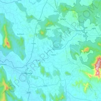
Name: Tansa River topographic map, elevation, terrain.
Average elevation: 84 m
Minimum elevation: 9 m
Maximum elevation: 836 m
Other topographic maps
Click on a map to view its topography, its elevation and its terrain.
Ulhas River
India > Maharashtra > Kalyan-Dombivli
Ulhas River, Kalyan-Dombivli, Thane, Maharashtra, 421301, India
Average elevation: 17 m
Bhatsa
India > Maharashtra > Kalyan-Dombivli
Bhatsa, Kalyan-Dombivli, Thane, Maharashtra, 421301, India
Average elevation: 32 m