
Edgbaston Reservoir topographic map
Interactive map
Click on the map to display elevation.
About this map
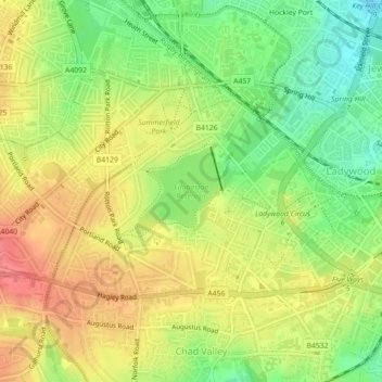
Name: Edgbaston Reservoir topographic map, elevation, terrain.
Average elevation: 155 m
Minimum elevation: 119 m
Maximum elevation: 188 m
Other topographic maps
Click on a map to view its topography, its elevation and its terrain.
Perrott's Folly
United Kingdom > England > Birmingham > Chad Valley
Perrott's Folly, Waterworks Road, Ladywood, Chad Valley, Birmingham, West Midlands Combined Authority, West Midlands, England, B16, United Kingdom
Average elevation: 153 m