
Réservoir Manicouagan topographic map
Interactive map
Click on the map to display elevation.
About this map
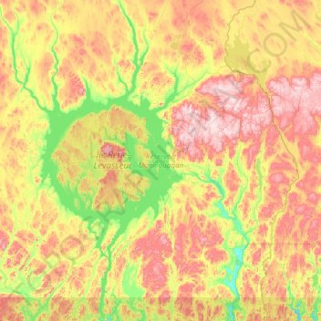
Name: Réservoir Manicouagan topographic map, elevation, terrain.
Average elevation: 553 m
Minimum elevation: 281 m
Maximum elevation: 1,101 m
Other topographic maps
Click on a map to view its topography, its elevation and its terrain.
Île René-Levasseur
Canadá > Quebec > Rivière-aux-Outardes
Île René-Levasseur, Rivière-aux-Outardes, Manicouagan, Côte-Nord, Quebec, Canadá
Average elevation: 474 m