
Isla San Marcos topographic map
Interactive map
Click on the map to display elevation.
About this map
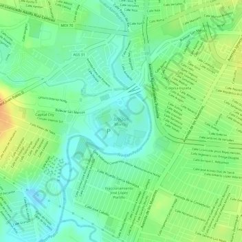
Name: Isla San Marcos topographic map, elevation, terrain.
Average elevation: 1,848 m
Minimum elevation: 1,832 m
Maximum elevation: 1,868 m
Other topographic maps
Click on a map to view its topography, its elevation and its terrain.
Parque Vistas de Oriente 2da Seccion
México > Aguascalientes > Aguascalientes
Parque Vistas de Oriente 2da Seccion, Aguascalientes, Municipio de Aguascalientes, Aguascalientes, México
Average elevation: 1,945 m