
San Gil topographic map
Interactive map
Click on the map to display elevation.
About this map
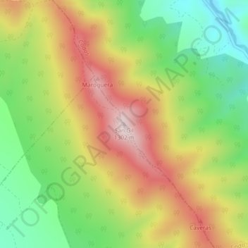
Name: San Gil topographic map, elevation, terrain.
Location: San Gil, Codos, Zaragoza, Aragon, Spain (41.25104 -1.34144 41.25114 -1.34134)
Average elevation: 1,066 m
Minimum elevation: 857 m
Maximum elevation: 1,298 m