
Indijk topographic map
Interactive map
Click on the map to display elevation.
About this map
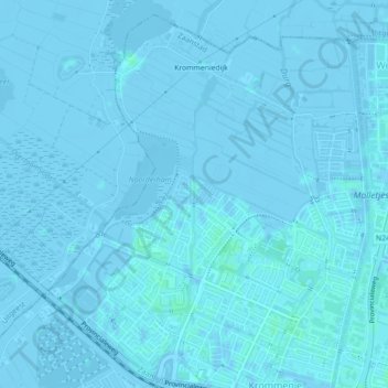
Name: Indijk topographic map, elevation, terrain.
Location: Indijk, Zaanstad, Noord-Holland, Nederland, 1562GK, Nederland (52.50061 4.75249 52.51694 4.75957)
Average elevation: 0 m
Minimum elevation: -6 m
Maximum elevation: 4 m
Other topographic maps
Click on a map to view its topography, its elevation and its terrain.
Zaanse Schans
Nederland > Noord-Holland > Zaanstad > Zaanse Schans
Zaanse Schans, Zaanstad, Noord-Holland, Nederland, 1509, Nederland
Average elevation: 0 m
Zaan
Nederland > Noord-Holland > Zaanstad
Zaan, Zaanstad, Noord-Holland, Nederland, 1502AB, Nederland
Average elevation: 2 m
Zaan
Nederland > Noord-Holland > Zaanstad
Zaan, Zaanstad, Noord-Holland, Nederland, 1502AB, Nederland
Average elevation: 2 m
Oostzanerveld
Nederland > Noord-Holland > Zaanstad
Oostzanerveld, Middellandse Zee, Zaandam, Zaanstad, Noord-Holland, Nederland, 1503BX, Nederland
Average elevation: 0 m