
Turlapadu topographic map
Interactive map
Click on the map to display elevation.
About this map
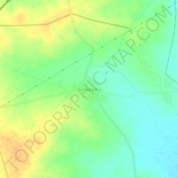
Name: Turlapadu topographic map, elevation, terrain.
Location: Turlapadu, Chandarlapadu, NTR District, Andhra Pradesh, India (16.68074 80.24305 16.72074 80.28305)
Average elevation: 47 m
Minimum elevation: 31 m
Maximum elevation: 64 m
Other topographic maps
Click on a map to view its topography, its elevation and its terrain.
Bobbellapadu
India > Andhra Pradesh > Chandarlapadu
Bobbellapadu, Chandarlapadu, NTR District, Andhra Pradesh, 521182, India
Average elevation: 53 m