
Castlecat topographic map
Interactive map
Click on the map to display elevation.
About this map
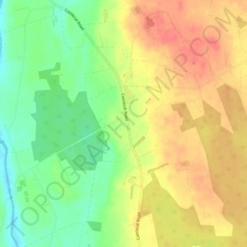
Name: Castlecat topographic map, elevation, terrain.
Average elevation: 57 m
Minimum elevation: 24 m
Maximum elevation: 85 m
Other topographic maps
Click on a map to view its topography, its elevation and its terrain.
Ardihannon
United Kingdom > Northern Ireland > Bushmills
Ardihannon, Bushmills, County Antrim, Northern Ireland, United Kingdom
Average elevation: 28 m
Ballylinny
United Kingdom > Northern Ireland > Bushmills
Ballylinny, Bushmills, County Antrim, Northern Ireland, United Kingdom
Average elevation: 34 m