
Vembakottai topographic map
Interactive map
Click on the map to display elevation.
About this map
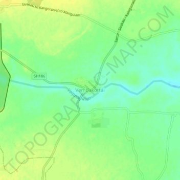
Name: Vembakottai topographic map, elevation, terrain.
Location: Vembakottai, Sivakasi, Virudhunagar District, Tamil Nadu, India (9.31260 77.74857 9.35260 77.78857)
Average elevation: 86 m
Minimum elevation: 74 m
Maximum elevation: 95 m
Other topographic maps
Click on a map to view its topography, its elevation and its terrain.
Anaiyur
India > Tamil Nadu > Sivakasi > Anaiyur
Anaiyur, Sivakasi, Virudhunagar District, Tamil Nadu, 626123, India
Average elevation: 113 m