
Petržalka topographic map
Interactive map
Click on the map to display elevation.
About this map
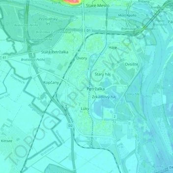
Name: Petržalka topographic map, elevation, terrain.
Average elevation: 138 m
Minimum elevation: 129 m
Maximum elevation: 215 m
Other topographic maps
Click on a map to view its topography, its elevation and its terrain.
District of Bratislava V
Slovakia > Region of Bratislava > District of Bratislava V
District of Bratislava V, Bratislava, Region of Bratislava, Slovakia
Average elevation: 137 m