
Macquarie Island Station topographic map
Interactive map
Click on the map to display elevation.
About this map
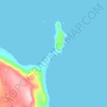
Name: Macquarie Island Station topographic map, elevation, terrain.
Location: Macquarie Island Station, Huon Valley, Tasmania, Australia (-54.51886 158.91779 -54.47886 158.95779)
Average elevation: 34 m
Minimum elevation: 0 m
Maximum elevation: 292 m