
Whitemark topographic map
Interactive map
Click on the map to display elevation.
About this map
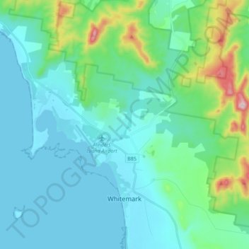
Name: Whitemark topographic map, elevation, terrain.
Location: Whitemark, Flinders Council, Tasmania, Australia (-40.14765 147.94947 -40.01806 148.09346)
Average elevation: 82 m
Minimum elevation: 0 m
Maximum elevation: 488 m