
Plappally topographic map
Interactive map
Click on the map to display elevation.
About this map
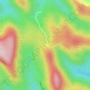
Name: Plappally topographic map, elevation, terrain.
Location: Plappally, Ranni, Pathanamthitta, Kerala, India (9.38156 76.95647 9.40156 76.97647)
Average elevation: 329 m
Minimum elevation: 146 m
Maximum elevation: 514 m
Other topographic maps
Click on a map to view its topography, its elevation and its terrain.
Chethonkara
Chethonkara, Ranni, Pathanamthitta District, Kerala, 689675, India
Average elevation: 59 m
Perumthenaruvi
India > Kerala > Ranni > Varkkalamukku
Perumthenaruvi, Varkkalamukku, Ranni, Pathanamthitta, Kerala, India
Average elevation: 158 m
Perunthenaruvi Checkdam
India > Kerala > Ranni > Kurumbanmoozhy
Perunthenaruvi Checkdam, Kurumbanmoozhy, Ranni, Pathanamthitta, Kerala, 686510, India
Average elevation: 123 m