
Mahagaon topographic map
Interactive map
Click on the map to display elevation.
About this map
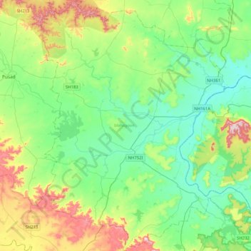
Name: Mahagaon topographic map, elevation, terrain.
Location: Mahagaon, Yavatmal, Maharashtra, India (19.64146 77.61652 20.02461 77.96116)
Average elevation: 346 m
Minimum elevation: 246 m
Maximum elevation: 603 m
Other topographic maps
Click on a map to view its topography, its elevation and its terrain.
Kanha
India > Maharashtra > Mahagaon
Kanha, Mahagaon, Yavatmal District, Maharashtra, India
Average elevation: 315 m
Dharegaon
India > Maharashtra > Mahagaon
Dharegaon, Mahagaon, Yavatmal District, Maharashtra, India
Average elevation: 325 m