
Dooru topographic map
Interactive map
Click on the map to display elevation.
About this map
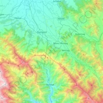
Name: Dooru topographic map, elevation, terrain.
Location: Dooru, Anantnag District, Jammu and Kashmir, India (33.38383 75.10175 33.68682 75.35733)
Average elevation: 2,297 m
Minimum elevation: 1,539 m
Maximum elevation: 4,360 m