
Mullingar topographic map
Interactive map
Click on the map to display elevation.
About this map
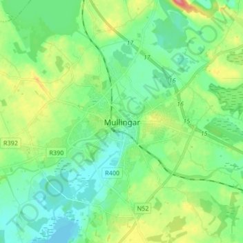
Name: Mullingar topographic map, elevation, terrain.
Location: Mullingar, County Westmeath, Leinster, N91 FY96, Ireland (53.48630 -7.38155 53.56630 -7.30155)
Average elevation: 101 m
Minimum elevation: 77 m
Maximum elevation: 161 m