
Albacete topographic map
Interactive map
Click on the map to display elevation.
About this map
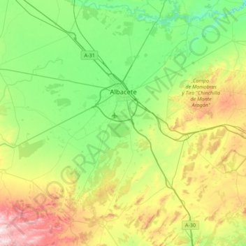
Name: Albacete topographic map, elevation, terrain.
Location: Albacete, Castile-La Mancha, Spain (38.67218 -2.18039 39.18626 -1.62279)
Average elevation: 786 m
Minimum elevation: 560 m
Maximum elevation: 1,341 m
The city is located in the southeast of the plain of La Mancha at an elevation of about 686 metres (2,251 feet). The local soil is low in organic matter and at risk, although slight, of erosion.