
Foix topographic map
Interactive map
Click on the map to display elevation.
About this map
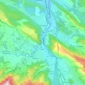
Name: Foix topographic map, elevation, terrain.
Location: Foix, Ariège, Occitania, Metropolitan France, 09000, France (42.93138 1.57131 43.00875 1.64706)
Average elevation: 525 m
Minimum elevation: 353 m
Maximum elevation: 1,143 m
Other topographic maps
Click on a map to view its topography, its elevation and its terrain.