
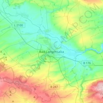
Bad Langensalza topographic map
Interactive map
Click on the map to display elevation.
About this map
Name: Bad Langensalza topographic map, elevation, terrain.
Average elevation: 259 m
Minimum elevation: 157 m
Maximum elevation: 500 m
Other topographic maps
Click on a map to view its topography, its elevation and its terrain.
Schönstedt
Germany > Thuringia > Unstrut-Hainich-Kreis
Schönstedt, Unstrut-Hainich, Unstrut-Hainich-Kreis, Thuringia, Germany
Average elevation: 237 m