
Ricabo topographic map
Interactive map
Click on the map to display elevation.
About this map
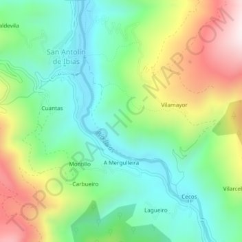
Name: Ricabo topographic map, elevation, terrain.
Location: Ricabo, Ibias, Asturias, España (43.02142 -6.87397 43.04142 -6.85397)
Average elevation: 476 m
Minimum elevation: 258 m
Maximum elevation: 874 m
Other topographic maps
Click on a map to view its topography, its elevation and its terrain.
San Antolín de Ibias
San Antolín de Ibias, Ibias, Asturias, España
Average elevation: 550 m