
Prince Edward Island topographic map
Interactive map
Click on the map to display elevation.
About this map
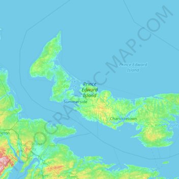
Name: Prince Edward Island topographic map, elevation, terrain.
Average elevation: 13 m
Minimum elevation: -3 m
Maximum elevation: 393 m
Other topographic maps
Click on a map to view its topography, its elevation and its terrain.
Kings County
Kings County, Prince Edward Island, Canada
Average elevation: 16 m