
Parque Félix Rodríguez de la Fuente topographic map
Interactive map
Click on the map to display elevation.
About this map
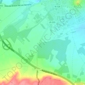
Name: Parque Félix Rodríguez de la Fuente topographic map, elevation, terrain.
Location: Parque Félix Rodríguez de la Fuente, Haro, La Rioja, España (42.56082 -2.86218 42.56153 -2.85939)
Average elevation: 484 m
Minimum elevation: 458 m
Maximum elevation: 546 m