
Philipsburg topographic map
Interactive map
Click on the map to display elevation.
About this map
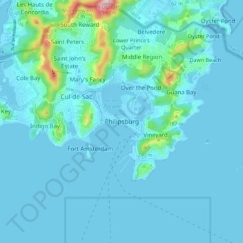
Name: Philipsburg topographic map, elevation, terrain.
Location: Philipsburg, Country of Sint Maarten, 721, Netherlands (17.98507 -63.08831 18.06507 -63.00831)
Average elevation: 33 m
Minimum elevation: -4 m
Maximum elevation: 377 m