
Berat topographic map
Interactive map
Click on the map to display elevation.
About this map
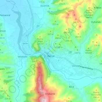
Name: Berat topographic map, elevation, terrain.
Location: Berat, Berat County, Southern Albania, 5001, Albania (40.68102 19.93353 40.72889 20.01839)
Average elevation: 145 m
Minimum elevation: 34 m
Maximum elevation: 520 m