
Osmangazi topographic map
Interactive map
Click on the map to display elevation.
About this map
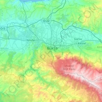
Name: Osmangazi topographic map, elevation, terrain.
Location: Osmangazi, Bursa, Marmara Region, Turkey (39.98014 28.92049 40.36249 29.26030)
Average elevation: 615 m
Minimum elevation: 0 m
Maximum elevation: 2,534 m
Other topographic maps
Click on a map to view its topography, its elevation and its terrain.