
Ashta topographic map
Interactive map
Click on the map to display elevation.
About this map
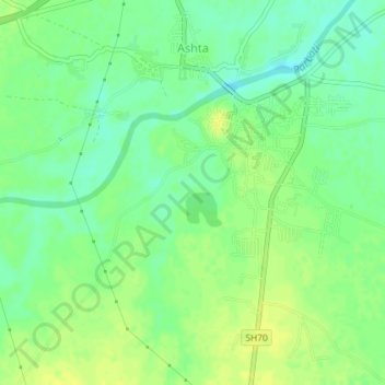
Name: Ashta topographic map, elevation, terrain.
Location: Ashta, Sehore, Madhya Pradesh, 466116, India (22.99751 76.70983 23.03083 76.73286)
Average elevation: 495 m
Minimum elevation: 485 m
Maximum elevation: 503 m