
Canning Vale topographic map
Interactive map
Click on the map to display elevation.
About this map
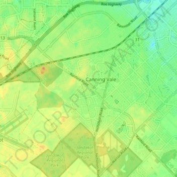
Name: Canning Vale topographic map, elevation, terrain.
Location: Canning Vale, Perth, Western Australia, 6155, Australia (-32.11548 115.88423 -32.05366 115.95165)
Average elevation: 27 m
Minimum elevation: 11 m
Maximum elevation: 42 m
Other topographic maps
Click on a map to view its topography, its elevation and its terrain.
Altone Park
Australia > Western Australia > Perth
Altone Park, Beechboro, Perth, Western Australia, Australia
Average elevation: 24 m