
Pennagaram topographic map
Interactive map
Click on the map to display elevation.
About this map
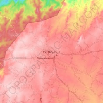
Name: Pennagaram topographic map, elevation, terrain.
Location: Pennagaram, Dharmapuri District, Tamil Nadu, 636810, India (12.09317 77.85923 12.17317 77.93923)
Average elevation: 490 m
Minimum elevation: 332 m
Maximum elevation: 535 m
Pennagaram is located at 12°08′N 77°54′E / 12.13°N 77.9°E / 12.13; 77.9. It has an average elevation of 493 metres (1617 feet). The famous tourist place Hogenakkal Falls, is 15 km from Pennagaram. Crocodile farm is available in Hogenakkal.