
Nehru Place topographic map
Interactive map
Click on the map to display elevation.
About this map
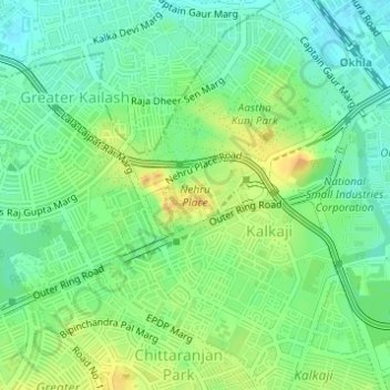
Name: Nehru Place topographic map, elevation, terrain.
Location: Nehru Place, Kalkaji Tehsil, South East Delhi, Delhi, India (28.54629 77.24830 28.55225 77.25850)
Average elevation: 227 m
Minimum elevation: 212 m
Maximum elevation: 246 m
Other topographic maps
Click on a map to view its topography, its elevation and its terrain.