
Rumchu topographic map
Interactive map
Click on the map to display elevation.
About this map
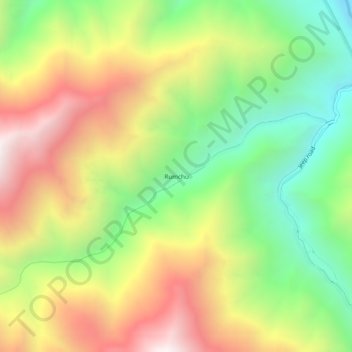
Name: Rumchu topographic map, elevation, terrain.
Location: Rumchu, Leh District, Jammu and Kashmir, India (34.09043 77.37175 34.13043 77.41175)
Average elevation: 3,790 m
Minimum elevation: 3,149 m
Maximum elevation: 4,552 m