
Ribes de Freser topographic map
Interactive map
Click on the map to display elevation.
About this map
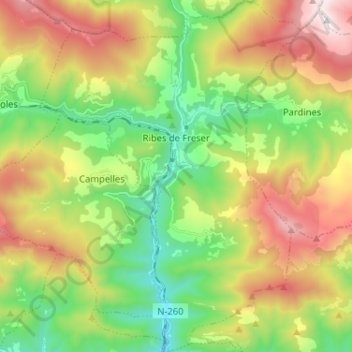
Name: Ribes de Freser topographic map, elevation, terrain.
Location: Ribes de Freser, Ripollais, Gérone, Catalogne, Espagne (42.24749 2.11779 42.34283 2.21352)
Average elevation: 1,347 m
Minimum elevation: 777 m
Maximum elevation: 2,200 m