
Goubellat topographic map
Interactive map
Click on the map to display elevation.
About this map
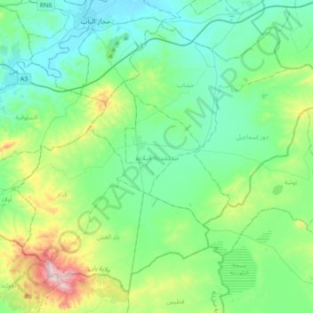
Name: Goubellat topographic map, elevation, terrain.
Location: Goubellat, Béja, 9080, Tunisie (36.41086 9.52594 36.64666 9.86413)
Average elevation: 193 m
Minimum elevation: 50 m
Maximum elevation: 715 m
Other topographic maps
Click on a map to view its topography, its elevation and its terrain.
Barrage Sidi Salem
Barrage Sidi Salem, Mezougha, Testour, Béja, Tunisie
Average elevation: 139 m
Téboursouk
Tunisie > Béja > Téboursouk
Téboursouk, Teboursouk Ville, Teboursouk, Béja, 9040, Tunisie
Average elevation: 402 m
Barrage Sidi El Barrak
Barrage Sidi El Barrak, Ezzouaraa, Nefza, Béja, Tunisie
Average elevation: 48 m