
Dighi topographic map
Interactive map
Click on the map to display elevation.
About this map
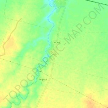
Name: Dighi topographic map, elevation, terrain.
Location: Dighi, Nandura, Buldhana, Maharashtra, India (20.84338 76.31554 20.88338 76.35554)
Average elevation: 256 m
Minimum elevation: 238 m
Maximum elevation: 267 m
Other topographic maps
Click on a map to view its topography, its elevation and its terrain.
Dighi
India > Maharashtra > Dighi
Dighi, Shrivardhan, Raigad, Maharashtra, 402401, India
Average elevation: 39 m